Moesser Granary, est. 1878, was one of the first structures built in western Salt Lake Valley. In 2014, the structure was preserved and moved to a historic pioneer crossing on the Jordan River Parkway Trail.
Steamboat Rock in Echo Canyon near the Wyoming border. Travelers using the Mormon Overland Trail named this formation after a steamboat bow. From 1847 to 1867, 80,000 Mormon immigrants traveled this way by wagon and handcart.
Big Cottonwood Canyon Creek runs below Wasatch Boulevard. The creek is a major source of water for Salt Lake City.

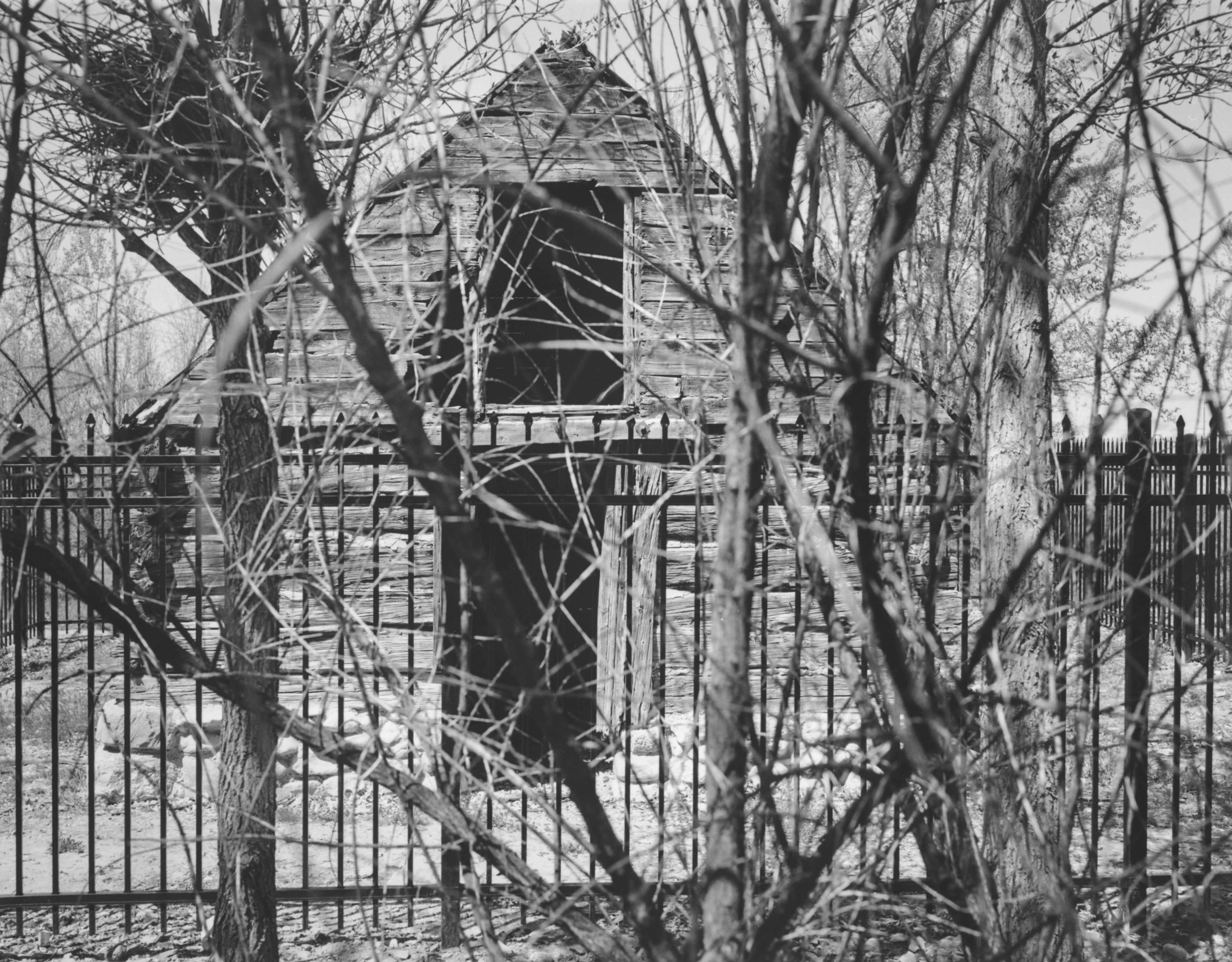
The last remaining dwelling on former FLDS leader Rulon Jeffs’ 4.5 acre compound sits at the mouth of Little Cottonwood Canyon. The compound included a school: Alta Academy. Rulon’s son, Warren Jeffs, was the principal and a teacher at the school for 22 years. The academy's motto was, "perfect obedience produces perfect faith.''
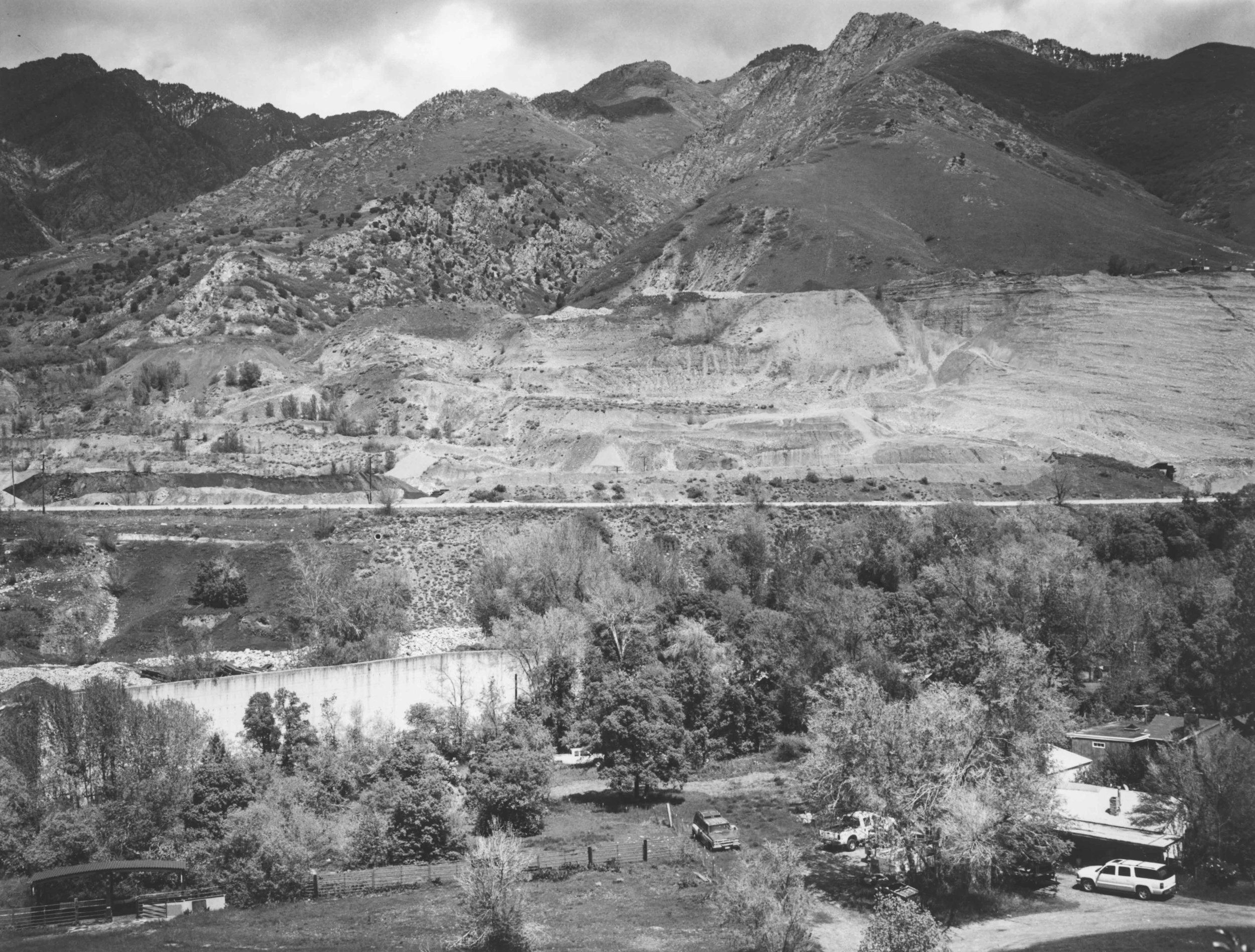
In Cottonwood Heights, Wasatch Boulevard sits below a gravel pit near the mouth of Big Cottonwood Canyon. The boulevard is parallel to the Bonneville Shoreline, the eroded edge of a massive prehistoric lake.
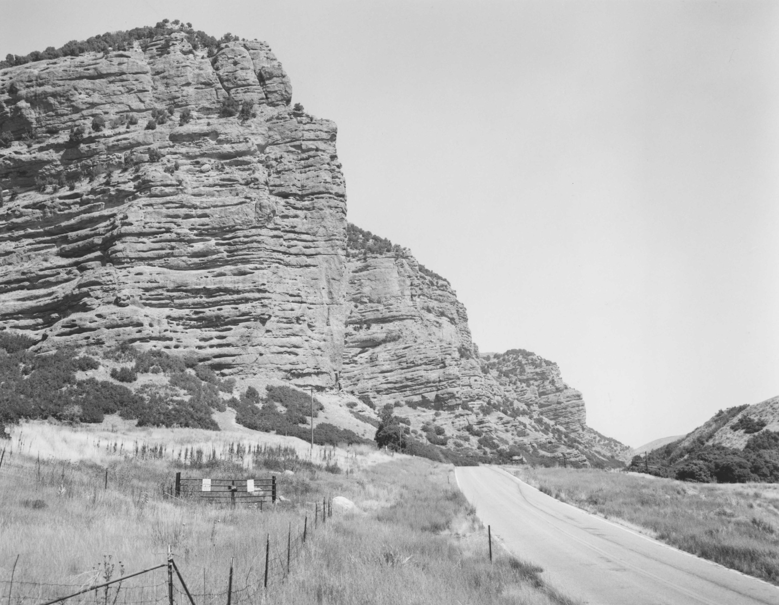
Suicide Rock sits at the mouth of Parley’s Canyon. Local lore says it was named after a heartbroken Native American woman who threw herself from the rock’s edge after learning of her true love’s death in battle.
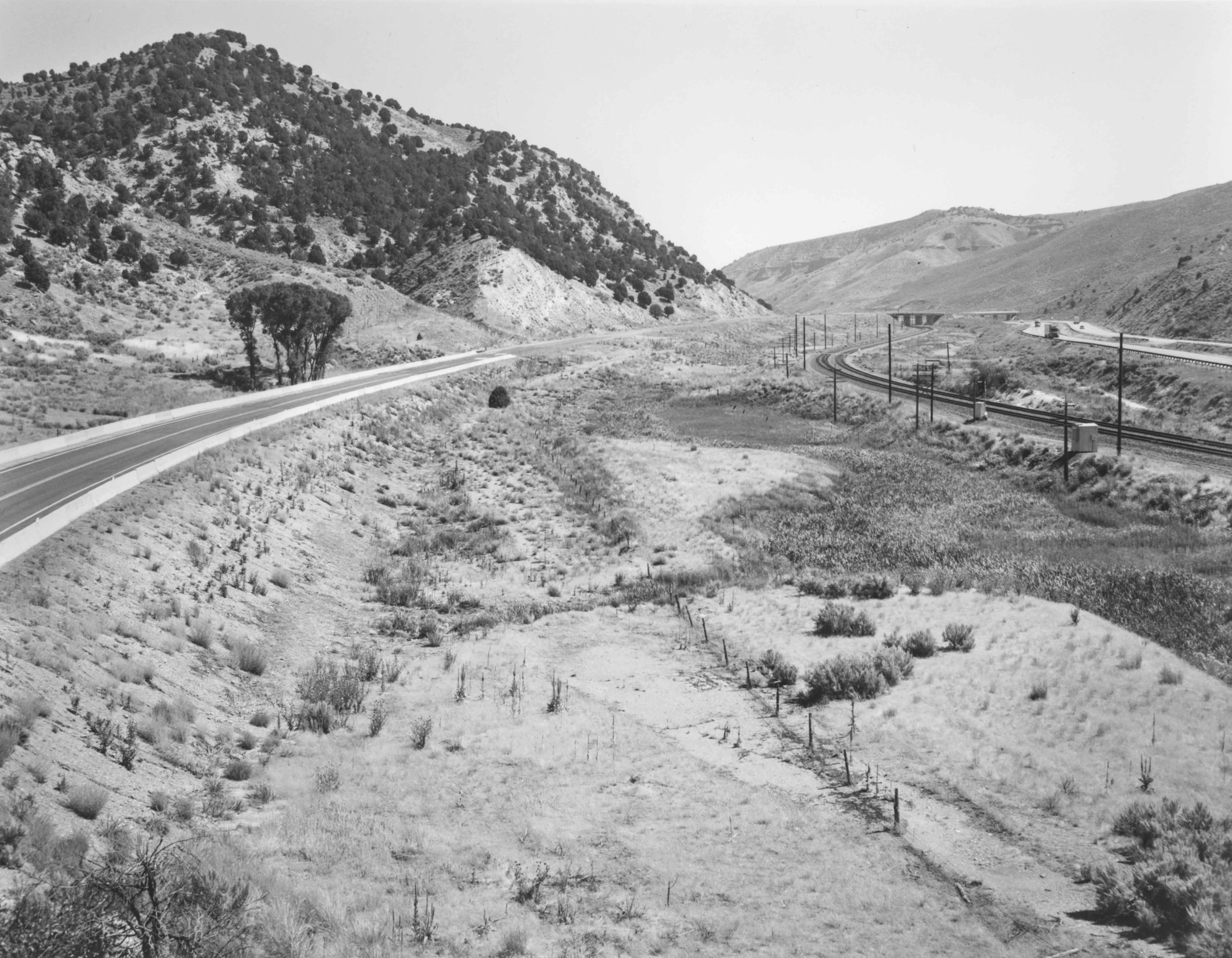
The overland trail through Echo Canyon was one of the most important routes for westward expansion. Buffalo, Native Americans, and fur trappers used this natural corridor between Wyoming and the salt deserts to the west. Then came the wagon trains, the Mormon Pioneers, gold prospectors, the Overland Stage, the Pony Express, the Union Pacific Railroad, the Transcontinental Telegraph Line, the Lincoln Highway, and Interstate-80.
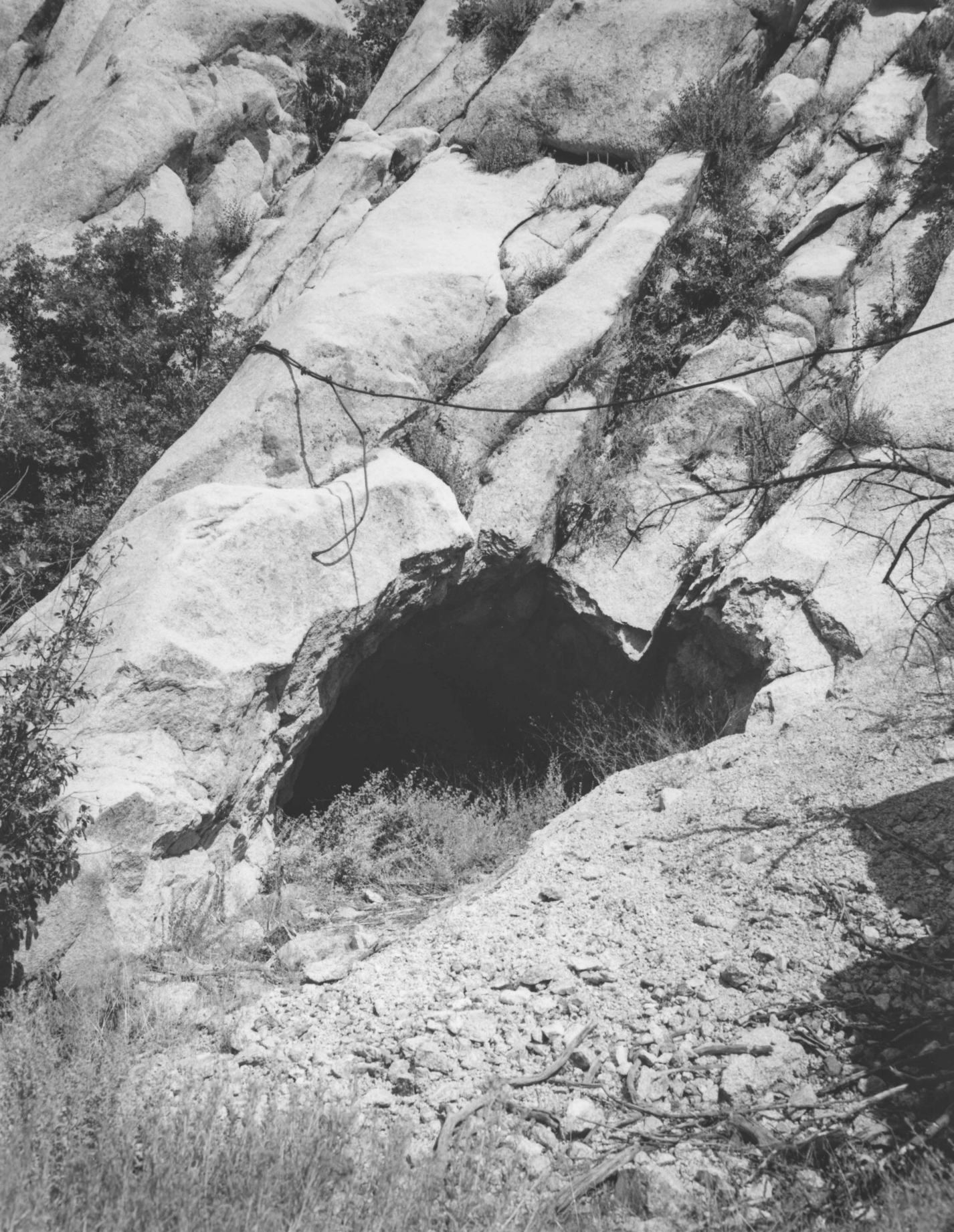
A storage cave in a granite cliff at the site of the Upper LDS Temple Granite Quarry in Little Cottonwood Canyon. For 40 years, the church quarried granite to build the walls of the Salt Lake Temple. It took three to four days to carry the stone the 20 miles to downtown Salt Lake City. With the advent of the railroad, stones could be moved to the Temple grounds in four hours.
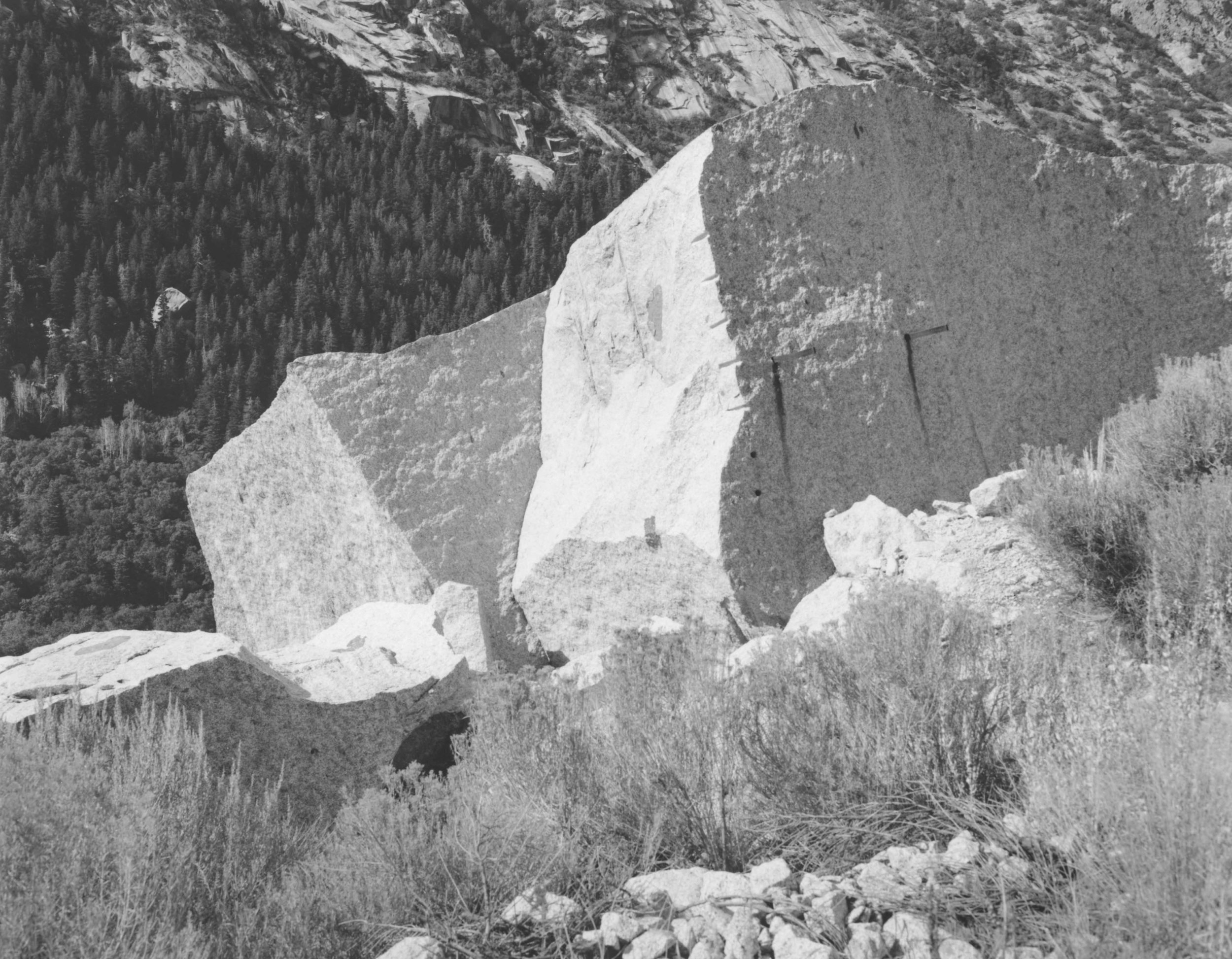
Jagged edges lined with drill holes and scaffold supports reveal the efforts of past Temple quarrymen at the Upper LDS Temple Granite Quarry in Little Cottonwood Canyon.
Traversing Echo Canyon, Interstate-80 follows the historic Mormon Overland Trail. In 1858, the U.S. Army was sent to Utah to quell the Mormon Rebellion and enforce laws prohibiting polygamy. A Mormon militia built fortifications in Echo Canyon to deter the soldiers.
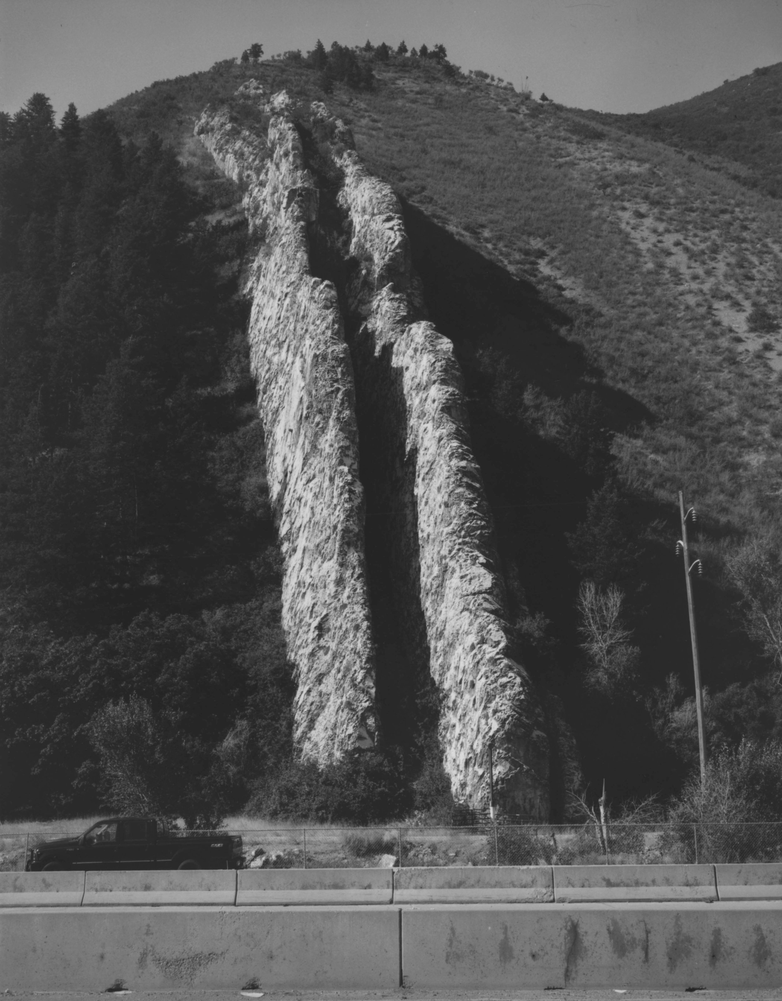
Devil’s Slide is a bizarre, giant-size limestone chute, located on the south side of Interstate- 84 in Weber Canyon, Utah. This site is a tilted remnant of sediments deposited in a sea that occupied Utah’s distant geologic past.
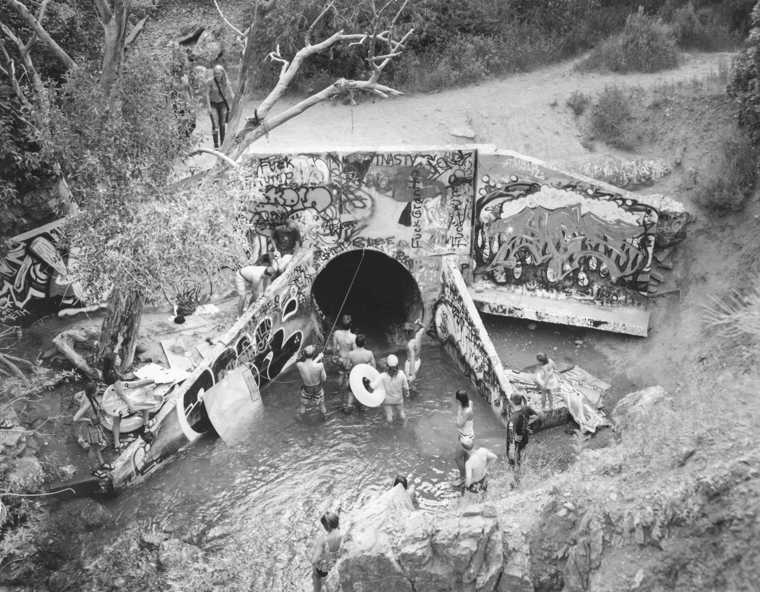
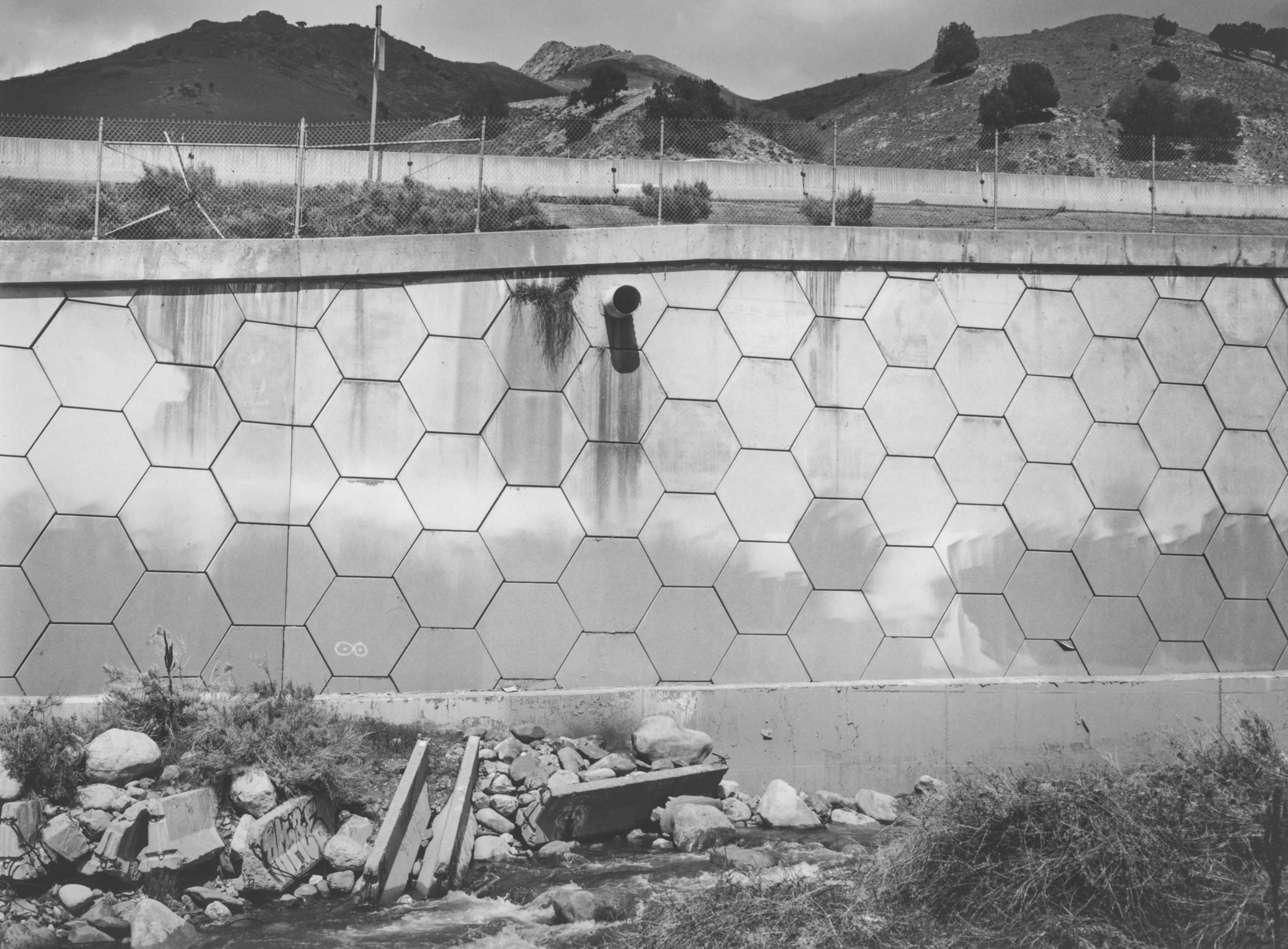
In the summer months young locals watch and wait to “shoot the tube” through the Parley’s Creek culvert underneath Interstate 215.
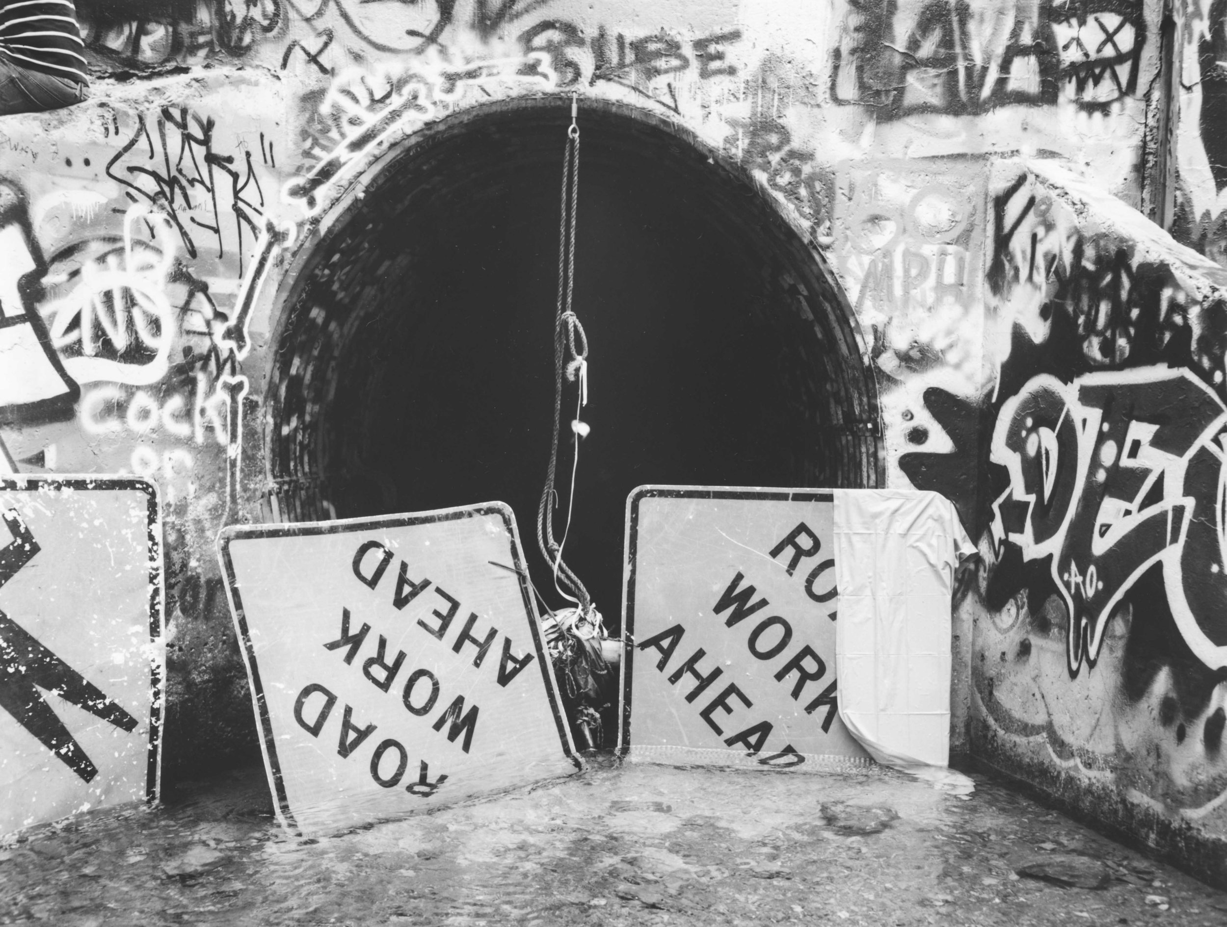
The Parley’s Creek culvert is blocked to hold back the flow to allow people to “shoot the tube.” For many years this site was a focal distribution point for Salt Lake City’s water supply.

Parley’s Creek flows through a culvert into Tanner Park.
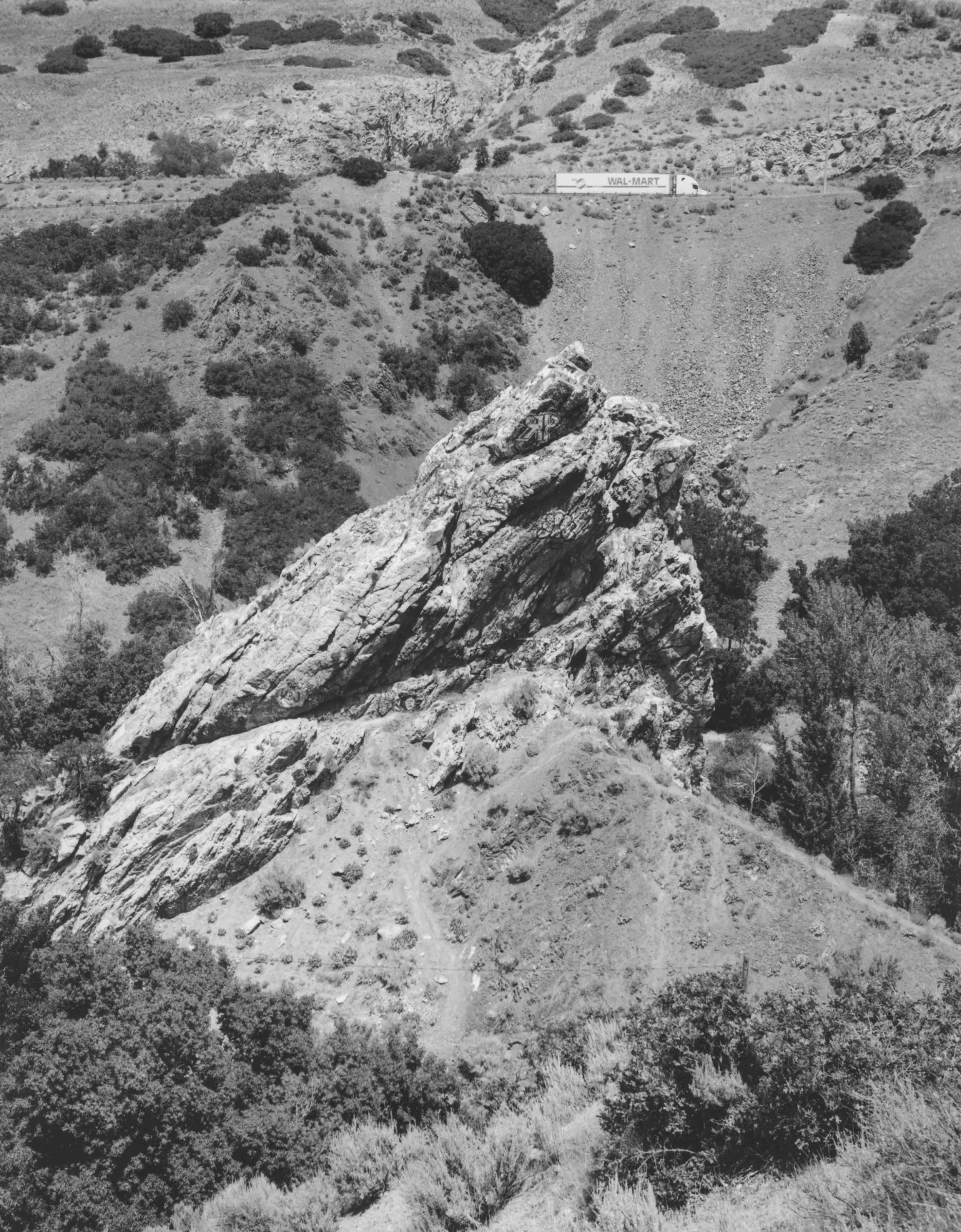
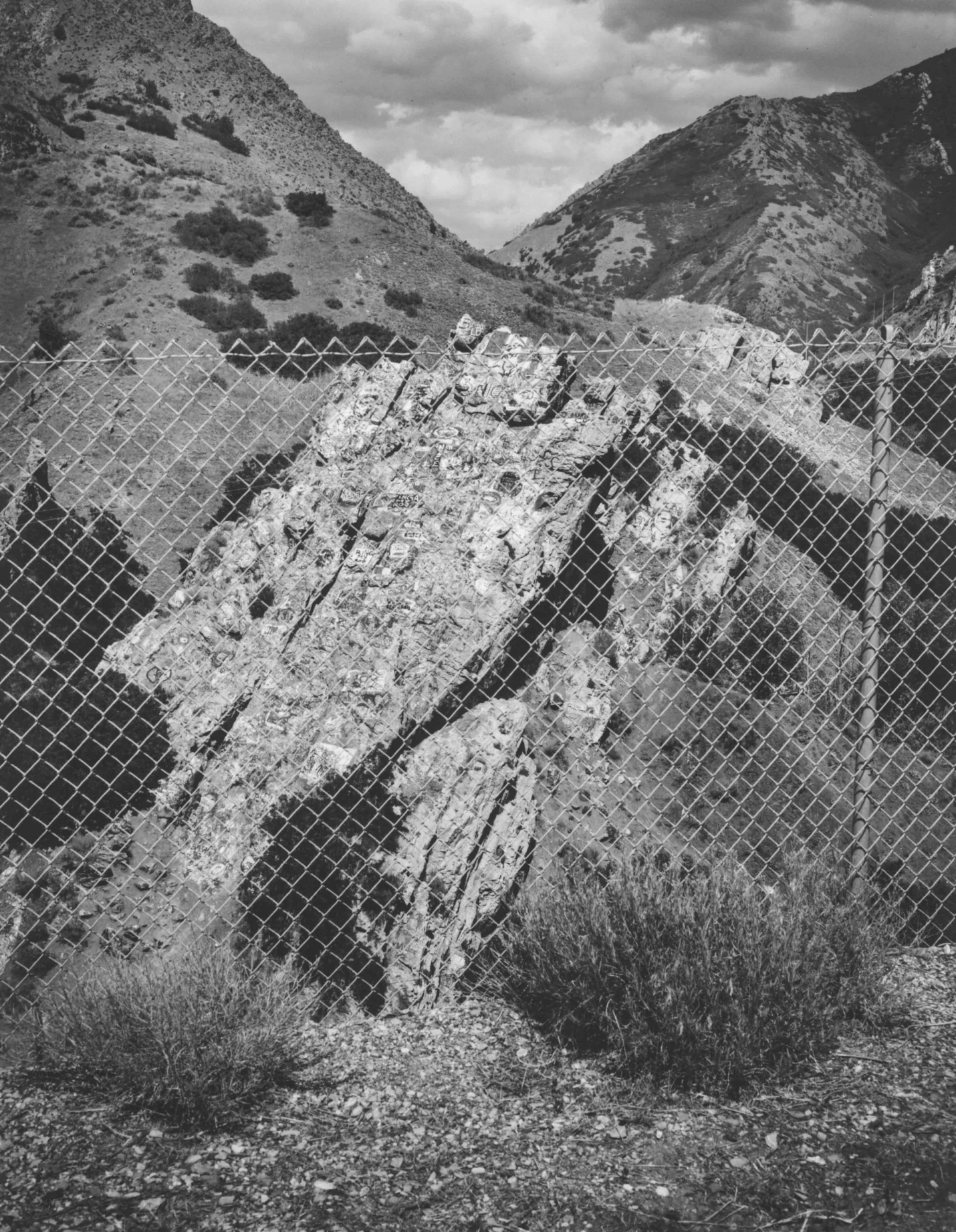
Suicide Rock juts out in front of Interstate-80 at the mouth of Parley’s Canyon. Much of the rock is covered in graffiti.